
HOPEWELL ROAD RALLY
Hocking Hills, Ohio
May 4, 5, 6 - 2018
When the list of the Seven Wonders of The World was compiled, the great pyramids of the Giza plateau were included, but not those in North or South America. Cohula Pyramid, located in Mexico, is the world's largest, covering three and a half times the area of Cheops' Great Pyramid in Egypt. Cahokia Mound east of St.Louis likewise occupies more space than the largest Egyptian pyramid. North America is home to the largest effigy mounds, geometric earthwork complexes, and hilltop enclosures, with 90% of these located in Ohio. A millenium before George Washington ever heard of this place the people we call Hopewell were constructing a road lined with embankments through the Ohio Valley connecting two vast complexes of these earthworks. This is the Great Hopewell Road.
Our historically-themed rally takes place May 4-6, 2018, and is named in honor of the Great Hopewell Road. The rally features two guided rides on Saturday, each of which takes a group to these impressive geometric earthworks, effigy mounds, and hilltop enclosures. The historic sites include Hopewell Culture National Park, Serpent Mound, Seip Mound, Fort Hill, Leo Petroglyphs, Ash Cave, Alligator Mound, The Great Circle, the Octagon, and Flint Ridge, source of that important mineral for peoples all over eastern North America.
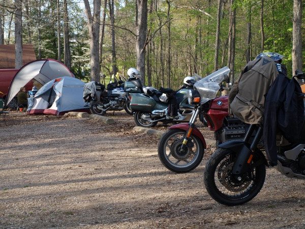
Location is the HAPPY HILLS CAMPGROUND, on State Route 278, 7 miles south of Nelsonville, Ohio(MAP). The campground is a motorcycle friendly,beautiful park-like setting with a large pond. The locationfeatures a camp store, electrical and primative sites, hot showers, a couple small cabins and wifi availablity. Seven miles away is Lake Hope State Park which has a large recreational lake, rental cabins and a dinning lodge specializing in house smoked meats. The rally offers some of the best riding roads east of the Mississippi River, and the location is virtually surrounded by Zaleski State Forest and Wayne National Forest, so there are plenty of dual sport riding options nearby on forest roads and dirt trails. And only 30 miles away is the beautiful, geologically unique Hocking Hills Region
Registration
Registration at the gate is $60. Early discounted registration is offered, but was closed March 31st. In order to guarantee a Saturday night meal, you must register by April 19.
The rally fee covers two nights of camping, Friday and Saturday night meals, guided historical tours of the earthworks and mounds, self-guided tours, endless coffee, Saturday night movies and door prizes. Rally is limited to 150 attendees.
For Rally Info and Registration – visit
Rally is hosted by the Southeast Ohio Beemers, you can visit them on facebook.
22245 State Route 278, Nelsonville, OH 45764, 740-385-6720
Located 8 miles south of Nelsonville and 1/2 mile north of SR 56.
<Registration includes basic camping fee for two nights. For electrical hookup, RV/camper space, wifi access, cabins and other camping specific information, contact the campground directly. Lake Hope State Park is located 7 miles south on SR 278 where there are many rental cabins, a large lake, hiking trails, and a very good Dining Lodge. Athens, the home of Ohio University is 14 miles East on SR 56.
Tentative General Schedule
FRIDAY May 4 ----
12:00 pm – 7:00 pm Registration
5:00 pm – 8:00 pm Chili & fixin's Supper
8:00 pm – 9:00 pm Mound Builders Talk
9:00 pm – 11:00 pm Chiller Theater movies
SATURDAY May 5 ----
8:00 am – 3:00 pm Registration
8:00 am – 10:00 am Breakfast on your own
8:30 am – 8:45 am Guided Ride Orientation
9:00 am -- 4:30 pm Guided & Self Guided Rides
6:00 pm – Dinner followed by Awards
9:00 pm – 11:00pm Saturday Night movies
SUNDAY May 6 ----
8:00 am – 10:00 am Breakfast on your own
10:00 am – 12 pm Goodbyes and Depart
Awards Categories
Longest Distance, Male
Longest Distance, Female
Youngest Rider
Oldest Rider
Oldest BMW ridden to rally
Best BMW
Local Riding Tips
You no doubt have already noticed from maps or experience that the roads in this area are hilly and curvey, often at the same time. If you typically ride freeways or live in a flat region, these roads may prove to be a challenge to you, so we're providing a few tips about riding in the region to help make your experience more enjoyable and safer.
The best strategy to deal with the winding and hilly roads is toride at a comfortable speed and always be prepared for the unexpected. In early spring the roads often have a spot of gravel from winter road treatment at the apex or at the inside edge of turns. It can be startling if you unexpectedly hit a patch, you may experience a brief slip, but don't panic, just hold your line, and you will be through it almost before you can react. The forested and rural terrain means that there is a possibility of deer moving about, sobe aware and scan the sides of the road ahead of you to spot any animals before they move to cross the road. In general, the deer are much less of a problem at this time of year than late Summer and Fall.
The terrain has also affected road construction. Many tight turns on these roads are decreasing radius turns, meaning that the further you ride into the turn, the tighter it gets. So keep a steady pace, being prepared to actually slow down or speed up depending on whether the turn tightens or if you see an exit from the turn coming up. Another issue is that a few too many turns are "off camber," meaning that the road slopes to the side in the opposite direction from the direction it is turning, e.g. the road turns left, but the lane you're in slopes to the right. Again, a steady, moderate speed in the turn is the best defense, and try to do your breaking before the turn, not in it, unless absolutely necessary. Another concern is the many blind hills, where you can't see past the crest of a small rise in the road. When approaching a blind hill, you should just assume that there is a car approaching from the other direction and will be over the line, partially in your lane, when it crests the hill. So ease over to the outside of the road when coming to and over a blind hill. Luckily most roads here have good signs marking unusual, or unexpected turns. Pay attention to them, but also understand that while they may warn you of the general direction of an upcoming turn, they don't always tell you how the road actually does turn. For example, a yellow diamond sign with an arrow might show a 90 degree right turn coming up, but in reality that turn may actually be 120 degrees or more! But at least you have been forewarned to be alert for a tight right turn. On a specific note, the road from the campground to Nelsonville includes a twisty downhill stretch desending to the river valley before approaching Nelsonville. This is a steeper downhill grade than it looks, and it is easy to get going too fast for some of the tight turns on the decent if you are not familiar with the road - take it easy!
Now all this may sound ominous, but really the roads are great. Don't worry, just get out on these great roads and enjoy them - our bikes were made for riding roads like these!
Adventure Riders: Nearby state forest roads are typically hardpacked dirt/gravel, often covered in a thin layer of loose gravel. In places some forest roads may run for a short distance on smooth bedrock. Some of the roads traverse fairly steep hills and have swithcbacks, and you may find some washboarding, most likely on hills. You may alson find shallow pot holes in the gravel, but a scouting ride on some of our routes showed that the forest roads are in generally good shape. Wayne Natioanl Forest has miles of off road trails, but a usage pass is required to ride them. Passes are available at the Forest headquarters on US33 South of Nelsonville.
Navigation
There are many "dead zoness" in the region where there is no cell phone coverage. If you rely on a cell phone or on-line navigation system like Google Maps, you will not be able to receive navigation data in thse dead zones, and your navigation will not work. If you want to use this type of navigation you should download maps of the area when you are connected to the internet before you come to the area. When you are in the region and want to navigate, just load the downloaded map instead of using on-line data. Consult your phone's navigation program for specifics. If you use a dedicated GPS like a Garmin or others which have preloaded maps, you do not need to worry.
Local Gas/Food
The nearest gas stations are located in Nelsonville, 8 miles north on SR 278. Athens is a major retail center and is 14 mi east on SR 56. If you are travelling through the Hocking Hills, there are a couple of gas stations near the park area, and more are located in Logan and Macarthur, both about 20 mi. away. The nearest restaurants are at the Lake Hope Dining Lodge ( 7 mi.) and in Nelsonville (8 mi.), as well as Athens (14 mi.) Lake Hope Dinning Lodge opens at 11 am and at 10 am on Sundays for their Sunday Brunch. Groceries are located in Nelsonville and Athens, and of course many gas stations double as convenience stores as well.


