
How to “Get There Dry”
Sport Touring Corner
By Norm Kern
When I first started riding back in the 1960s, motorcycles were rapidly rising in popularity and there were lots of new riders. Those who didn’t catch “bike fever” all had friends who did. They thought we were kind of crazy so they were constantly asking us questions to sort of challenge our judgment. One of the most common was, “What do you do if it rains?” to which one of my friends always replied, “You get wet!”
Not much has changed since then, and no rider I know looks forward to opportunities to ride in the rain. Most try to avoid it like the plague, and that’s not too difficult for those who only ride short distances- they simply take the car or stay home if it rains. Simple.
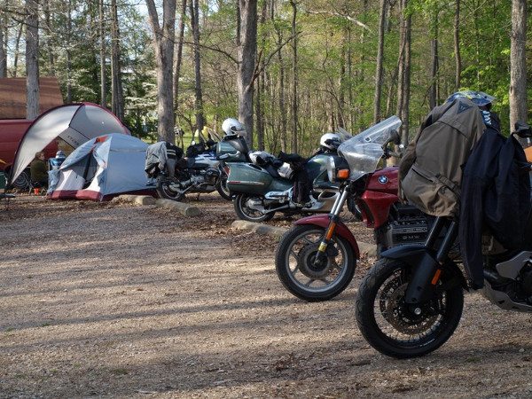
For those who do full day rides, rallies and multi-day trips, it’s more complicated. If you need to be someplace hundreds of miles away in some kind of time frame, avoiding rain and staying dry can be quite a challenge. Fortunately, modern communication and technology have given us access to more and better information. This month, I’d like to share some tools and techniques I use to avoid rain that will enable you to avoid rain while going pretty much where and when you want.
The first tool has been around forever, is available to every rider and is especially handy for judging what is just ahead. It’s the Windshield Wipers of oncoming vehicles.
- All wipers off- You’re good to go
- All wipers on- You’re going to get wet very soon
- Some wipers on- You might get by without getting too wet.
You may laugh, but this can be very handy when you are riding in and out of light rain. For example, if you hate to put on rain gear in hot humid weather and want to avoid it as long as possible, observing windshield wipers will help you decide when it’s time to stop and put on the gear.
Weather Radar
If you have your smart phone mounted on your bike where you can see it, a radar app can come in handy for dodging thunderstorms. You can see what conditions are around you and where you are going. If the app shows moving patterns, you can see what direction rain is moving. I’ve avoided many a thunderstorm by stopping for a lunch break at a strategic time. The latest Garmin zumo 590, 595 and 395 interface with a Garmin app on your phone to provide live radar superimposed on the GPS map. Sine the zumos are waterproof and work with gloves on you can see and manipulate them much better in rain than a smart phone. If you have access to a radar display, the colors on the map can be very helpful.
- Blue to Light Green- If you have a tall windshield and are moving at 60+ MPH you might be able to stay fairly dry without putting on rain gear. If the humidity is low, the rain under these conditions may be evaporating as it falls and you might not feel it. We should always be so lucky!
- Dark Green to Bright Yellow- You’ll need rain gear, but it will probably do its job and you won’t be too uncomfortable.
- Red, Brown, Purple- Most likely this will be a frog-strangler and it would be wise to get off the road to avoid aquaplaning and poor visibility.
When rain is combined with high humidity, there can be fog in the air that can also condense on your windshield and impair your vision. This is another good time to pull over.
Radar apps help you see much further ahead and you can sort of predict the future by seeing what the direction and speed of storms are, but they are limited in what they can offer for route planning.
A Better Way
If you are doing day rides or multi-day trips, wouldn’t it be nice to have a web page or app that lets you put in a route, then shows you what the weather will be along the way?
Get on your Web browser on your computer and go to http://get-there-dry.com/. It’s also available for iPhone at the iTunes Store. There is no App per se for Android, but you can access it through the Get there dry page on Facebook or access the regular web app through your Chrome browser.
I suggest you start out on your computer browser with the web page so you can experiment on a bigger screen where you have a regular keyboard. Let’s do a walk-through.
First step is to PLAN YOUR ROUTE. Select the motorcycle button on the left to get routes that are optimized for us. Type in a city, street address etc. for A START POINT of the route and B DESTINATION. I used PHILADELPHIA, PA, USA for the start and CONCORD, NH, USA for the destination in this demo. The + icon can be used to insert intermediate points to fine tune your route. When you are done, click anywhere in the blue CALCULATE ROUTE bar.
In a few moments, you will see the black info blocks with distance, time and a couple of options shown, then a map of the route appears with a GO button at the bottom. If you want the route to go a different way, you can go back up and add additional points between the START and DESTINATION points and recalculate.
Once you click the GO button, the route map updates with 4 or 5 symbols along the route. Symbols are very rough indicators of weather along the way.
The table at the bottom of the page is very powerful, as it shows conditions you will encounter along the route if you leave at the departure time shown at the top.
Here is another shot of the table for a different departure time. The background color of the Precipitation chance bar varies from white for 0% to dark blue for 100%. Background color for Temperature is yellow but lightens as temperatures drop. Background for Wind Speed is white for low speed but progressively pink for higher speed.
The departure time slider allows you to adjust it from the present to any time in the next forty hours by simply clicking and dragging it. The table updates instantly, so you can easily move the slider around to get the Precipitation chance bar to look as light as possible.
Here is a close look at the table. It shows the distance at the points shown on the route, expected time of arrival at the point based on the departure time set on the slider, chance of precipitation temperature, wind speed and direction. Wind direction is measured in degrees clockwise from due north, so a wind coming from the north has a wind direction of 0 degrees; wind from the east is 90 degrees; from the south it is 180 degrees and from the west it’s 270 degrees.
——————————————————————–
Connect with local Ohio MSTA riders at these monthly breakfasts:
Southwest Ohio Breakfast, 9AM September 15
Village Family Restaurant
144 S. Main St.
Waynesville, OH 45068
Central Ohio Breakfast, 8AM, October 7
Portside Cafe
6515 S High St
Lockbourne, OH 43137

